All roads lead to Rome, the saying goes. Well, all roads except for the Roman road of Watling Street, which at one end takes you to Dover (Dubris) and at the other Wroxeter (Viroconium) in Shropshire.
I was always only vaguely aware of this thoroughfare but the name began, in recent years, to nag on my weekly visits to Canterbury (Durovernum Cantiacorum). When approaching the city centre from the station, I would see a street sign bearing the name on the side of a branch of Boots. It took some time to dawn on me that this was the very same Watling Street I had been told about in school history classes. The street sign in Canterbury isn’t unique, though: ‘Watling Street, EC4’ is affixed to a wall a few minutes’ walk from London Bridge station.
Strictly speaking, Watling Street isn’t a Roman Road, as the trackway was first used by the pre-Celtic and then the Celtic inhabitants of Britain. The author of St Paul in Britain (1861), R. W. Morgan, recalled: ‘From Dover to Holyhead ran the British Causeway, constructed by Dynwal and his son, Beli the Great, 400 bc, called Sarn Wyddelin, or the Irish Road.’
Watling Street came to be associated with the Romans since they were the ones who paved it, beginning in 47 ad, soon after they invaded. Aulus Plautius, conqueror of Kent, also proceeded to straighten the grassy dirt path for the purpose of conveying his supplies and material of war from the Continent. From Shropshire, one tributary continued on the historical route to the tip of north-west Wales, while another headed north, past Hadrian’s Wall to Pictish Scotland.
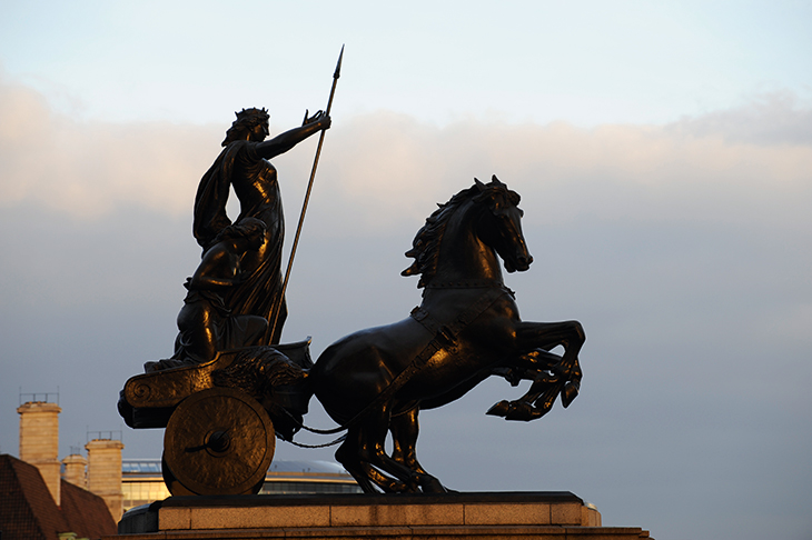
Its English name derives from the Anglo-Saxons who settled in St Albans (Verulamium) after the Romans had gone. They were a tribe named the Waeclingas, who dubbed the place Wætlingaceaster. By the 9th century the road passing through the settlement had become known as Wæclinga Stræt, a name eventually extended to the entire road. The pathway had by then achieved legend as the avenue on which Boudica was defeated in 60 or 61 ad. It later came to mark the south-west border of Danelaw. St Augustine used it on his way to Canterbury, as did pilgrims to the city’s cathedral, who returned wearing badges of Thomas Becket as a sign that they had made their virtuous journey. It is thus assumed that it was also the path taken by Chaucer’s pilgrims from Southwark.
Watling Street fell into disuse thereafter and only in the 18th century did it resume its role as a thoroughfare, when a toll system was established throughout England. By the 20th century, most sections of Watling Street had been transformed into modern roads, although some parts had fallen into disrepair. ‘A disused stretch of old Watling Street, a road which has been unaccountably neglected and is actually dangerous for fast motor traffic, is to undergo long overdue widening from St. Albans,’ reported Country Life in November 1936.
Today, that part of Watling Street has become the A5, while the section between Dover and Canterbury is the A2. Along the A2 travels the National Express coach route 007, after which Ian Fleming, resident of St Margaret’s Bay, named his secret agent.
Got something to add? Join the discussion and comment below.
Get 10 issues for just $10
Subscribe to The Spectator Australia today for the next 10 magazine issues, plus full online access, for just $10.
You might disagree with half of it, but you’ll enjoy reading all of it. Try your first month for free, then just $2 a week for the remainder of your first year.


Comments
Don't miss out
Join the conversation with other Spectator Australia readers. Subscribe to leave a comment.
SUBSCRIBEAlready a subscriber? Log in