Thirty-two years ago the young Nicholas Crane, who would go on to become one of England’s most esteemed television geographers, set out to woo a young woman by spiriting her off to the unfailingly romantic landscape of Chimborazo and Cotopaxi. The couple spent their high-altitude idyll walking the hills in hobnail boots, making river passage in dugout canoes and boarding a Quito-bound steam train through the Andes, run by the estimable Empresa de Ferrocarriles Ecuatorianos.
Their journey had its moments: at one stage both parties were to be found at 13,000 feet, crusted with ice and huddled overnight from the gales inside a pair of plastic rubbish bags; they then got themselves lost for a while among a wilderness of huge and very active volcanoes. But eventually they fetched up at the old ruined Inca fortress of Ingapirca, by now safe and sound and contentedly engaged to one another.
Moreover, the young Crane — who wisely travelled with the classic Inca history by John Hemming in his rucksack — found himself imbued with a lasting fondness for Andean exploration and adventure. His passion at long last now finds its expression in this engaging book about the French Geodesic Mission to the Equator, written not from some high-altitude Andean hideaway but from a study in Primrose Hill during lockdown.
Crane’s lure on this occasion was neither adventure nor potential matrimony but the rather more prosaic matter of triangles. To anyone remembering the fundamentals of Euclidean geometry, the triangle, with its three straight encompassing lines, is possessed of an immutable set of values.If you carefully measure one straight line, draw two intersecting others from its ends and then measure the angles that result, the lengths of the other two lines can be calculated with ease. So by using only very basic instruments, and providing that you stake out and determine with chains or tapes the length of that single base line,
you can measure any other length, anywhere.
You can think big with triangles, and back in the day people did. In order to determine the size of the planet the Estonian astronomer Friedrich von Struve did so in 1850 by measuring 1,000 miles of meridian from Hammerfest down to Odessa, in the process constructing some 250 triangles across forest and lakes too numerous to count. To begin the serious mapping of India, teams of some 700 surveyors and porters, working with theodolites weighing half a ton each, measured to the millimetre a great arc from Mount Everest to Cape Kanyakumari, which took more than 70 years to complete and which, between the Baltic and the Black Sea, employed the drawing of legions of triangles.
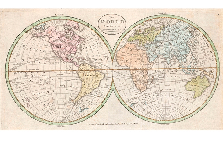
The shapes can also be employed to determine not just the planet’s size but its shape. Which was the purpose of the highly ambitious — and given what occurred one might say rather too ambitious — geodesic mission staged by the French in 1735 to see if the Earth at the equator was fatter than it might be at its poles. To see if, in other words, it was shaped as Isaac Newton had lately predicted (but which Descartes had doubted), more like an orange than an egg, or in proper terms was an oblate rather than a prolate spheroid.
Ecuador, the country whose name memorialises in Spanish the line of latitude on which it sits, was the logical place to perform such a survey. And so, after high-level negotiations between the colonial authorities of France and Spain — 18th-century Ecuador being run as a Spanish colony as part of the viceroyalty of Peru — it fell to a furiously volatile party of French scientists and malcontents to sail out southwestward from the Charente estuary to carry out the work in the faraway tropics. If they found from their measurements that the low-latitude lines by the equator were packed more closely together than the high-latitude lines already measured around Paris, say, or further up near North Cape, then the planet could fairly be said to be fat and orange-shaped, and Newton would be proved right.
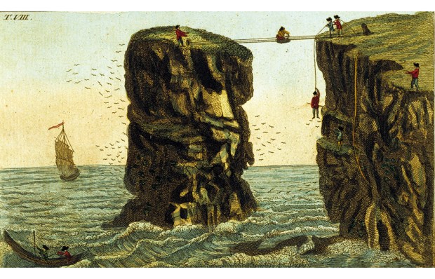
Their fantastical expedition is what Crane has chosen to describe, and his account of its slide into fully ten years of anarchic shambles in the jungle is exhaustively — sometimes exhaustingly — chronicled in Latitude. It is filled with such tales of bizarrerie and foolhardiness that one wonders how on earth the French and the interfering Spanish — all bombast, tantrums and war dogs, who transported from Europe among other things ample supplies of both gunpowder and wig powder — could have organised any kind of empire at all, let alone engaged in science of value.
And yet they did, against all odds —spending their decade away conducting surveys, measuring gravity, making maps, discovering new plants — in a world of thigh-deep mud, rat-sized mosquitoes, boiling steam-heat, giant landslides, impassable ravines, lethal snakes, fights and mutinies aplenty, and pursued by an encyclopedia-ful of foul diseases. The most memorable of the adventurers’ ills was a kind of anal gangrene, the agonisingly chafed sufferer’s attention being diverted on medical advice by having an equally painful poultice made of gunpowder, Guinea-pepper and a peeled lemon stuffed deep into his weeping rectum.
Such matters keep Crane’s narrative thrumming along nicely, although I am sorry to say that bewilderment sets in rather easily at times — not least because of an endless roll-call of names of people about whom we care very little, since they add so minimally to the tale. The French principals we of course note and either admire or loathe — Louis Godin (to be loathed) Pierre Bouguer (meh) and Voltaire’s close friend Charles-Marie de la Condamine (a fine fellow). But there are too many Spaniards included for no apparently good reason, and since they often have portmanteau names such as José Antonio Mendoza Caamaño y Sotomayor, or Juan Valparda y la Ormaza, and since they pop up with lamentable frequency, they tend to transform Crane’s prose in parts from mostly terrific to sometimes dismayingly turgid.
Among the surveying equipment taken out from France in 60 great boxes was a carefully machined iron rod, a copy of the standard toise, which at the time was, at around 6ft long, the basic unit of length used by the pre-metric French. The rod, coddled and protected as the key reference for all the expedition’s many measurements, came dramatically into its own when in January 1743 — nine years after leaving France — M.Bouguer calculated from the mission’s observations that one degree of Ecuadorian latitude measured 56,753 toises. He was aware that back up in Paris one latitude degree measured 57,060 toises, and up on the Arctic circle, 57,437. Equatorial latitudes were thus shorter, and by a lot.
So this was it, the moment of truth. The Earth was provably and incontrovertibly oblate in shape. And through gritted teeth the French adventurers who had so advanced the science formally told the world: Newton had been right, Descartes wrong. An admirable conclusion to what Crane has fashioned into an admirably told story.
Got something to add? Join the discussion and comment below.
Get 10 issues for just $10
Subscribe to The Spectator Australia today for the next 10 magazine issues, plus full online access, for just $10.
You might disagree with half of it, but you’ll enjoy reading all of it. Try your first month for free, then just $2 a week for the remainder of your first year.


Comments
Don't miss out
Join the conversation with other Spectator Australia readers. Subscribe to leave a comment.
SUBSCRIBEAlready a subscriber? Log in